Taos Soil and Water Conservation District has continued to assist local governments, municipalities, MDWCAs, and landowners with water related issues. The District either funded or participated in the following projects:
Taos SWCD Water Studies
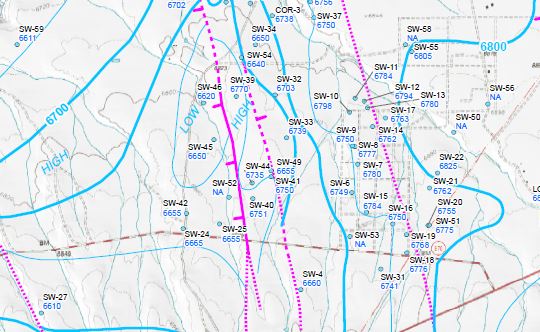
Taos Soil & Water Conservation District began water resource studies in 1995 and mapping of the water table throughout Taos County in early 2003. The District has accurately located and cataloged over 1,600 water wells. Analysis of well drillers’ logs associated with these wells has produced geologic data that allowed the study team to conclude that the groundwater of Taos County was compartmentalized. The movement and levels of groundwater aquifers are heavily influenced by geologic faults located below the surface topography. This concept was not previously described by early scientists who studied the area.
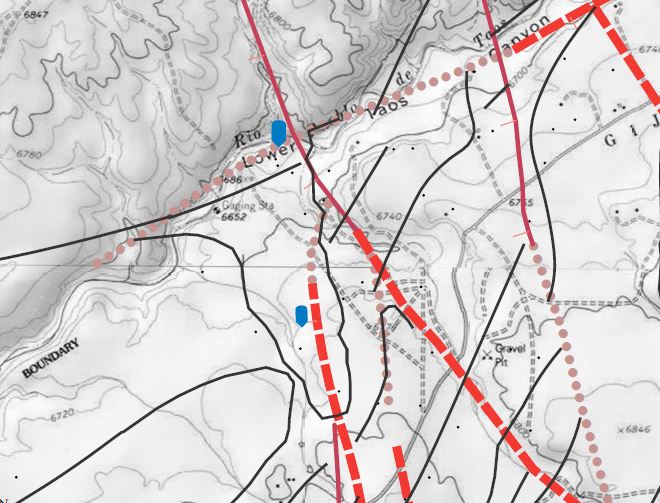
In the spring of 2004, Taos SWCD partnered with USGS and various local entities to fund an high-resolution aeromagnetic survey of the Taos Valley. Results of this survey have confirmed most of the District’s original fault locations as well as supporting the aquifer compartmentalization theory. These findings were presented at the New Mexico Geological Society 55th Annual Field Conference and published in the corresponding guidebook under the title of “Groundwater Geology of Taos County” by A.L. Benson. Additionally, the District contracted the NM Bureau of Geology to analyze approximately 500 water well samples for 39 different elements and ions. In late 2004, the District contracted with various water quality experts to further compile and research additional water samples.
In 2006, the District completed the water quality sample acquisition phase of the study. In 2008, Taos SWCD produced the first versions of these water quality maps (click here to see them). In 2010, the District collaborated with UNM-Taos to assist the NM Bureau of Geology in a water availability study of the southern Taos Valley which was commissioned by Taos County. The District utilizes the results of these studies on a regular basis and works with the County in the formulation of the Regional Water Plan, local Land-Use regulations and County subdivision reviews. Water Table / Quality data is available to the public by simply scheduling an appointment with District staff and/or consultants.
Taos Groundwater Contour Maps (Geologist: A. Benson, Map Preparation: DB Stephens & Associates)